Available for public comment is the final draft of the Kaslo South Development Plan and the Kaslo South Development Presentation. Please read the plan or watch the presentation and fill out the Comment Form. The survey is open December 16, 2025, to January 9, 2026.
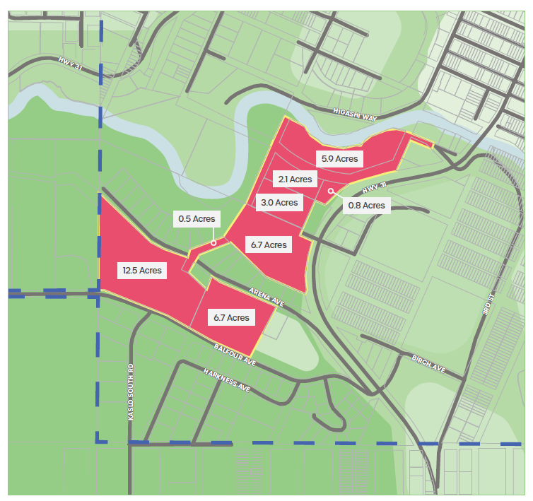
The South Kaslo Plan Area is located south and east of the Kaslo River and is bordered by Highway 31 to the west and Arena and Balfour Ave to the south. Downtown Kaslo is less than 1km away from the plan area, connected by Highway 31 and through a pedestrian bridge (Unity Bridge) across the Kaslo River.
Private lands along Arena Ave form a break in the north and south portions of the plan area, connected by a corridor of Village lands. The total site area is approximately 41.2 Acres / 166,730 square metres / 1,794,672 square feet.
The Village of Kaslo seeks to guide the development of the South Kaslo area in alignment with its Official Community Plan (OCP). To achieve this, a comprehensive plan is required to outline the logical extension of municipal services, identify potential amendments to the OCP, and establish a phased approach to development that is both efficient, cost-effective, and reflective of community priorities.
REPORTS AND DOCUMENTS
South Development Presentation (December 2025) **NEW**
South Development Plan DRAFT (November 2025) **NEW**
South Kaslo Development Plan: Early Directions - What We Heard Report (June 2025)
South Kaslo Early Directions (May 2025)
Kaslo South Development Plan Background Report (April 2025)
Engagement Plan (February 2025)
IMPORTANT DATES
Draft Plan Presentation Q&A - December 18, 6-7 pm online https://us02web.zoom.us/j/4857930110
The presentation and Q&A will also be streamed live in the Council Chamber at City Hall, 413 Fourth St.